Analysis
Words in italics are those of the developers' agents.

This little fellow is the "red herring alert." Non italicized words are the commentary of Bill Emory (me). I've lived in the neighborhood since 1987.
Analysis
Words in italics are those of the developers' agents.
This little fellow is the "red herring alert." Non italicized words are the commentary of Bill Emory (me). I've lived in the neighborhood since 1987.
Franklin Street PUD is located on Franklin Street off of East Market Street, less than one mile away from downtown Charlottesville. It is situated in the Woolen Mills Neighborhood, on the eastern edge of City of Charlottesville.
* Franklin Street is also located less than a mile away from Monticello and outside of the area the Charlottesville Planning Commission has designated for high density infill near the urban core.
Housing types in the neighborhood consists predominantly of single family detached along with a mixture of other housing types, mostly duplexes. A variety of land-uses and zoning co-exist in Woolen Mills, including some industrial uses in  close proximity to residential ones.
* This is code for "there isn't much down in the Woolen Mills that is worth while."
No mention of the neighborhood's 200 year history.
No mention of the Woolen Mills Neighborhood's vast inventory of historic properties.
No mention that the "lot in question" is Lot #1 of the original subdivision of the Woolen Mills Village back in 1885.
No mention that the house on Lot #1 was that of Warren S. Graves, a man who started working at the Mill in 1880 and was supervisor of the carding department at the Mill.
The subject property is currently zoned R-1S. (See fig. 1 .I).It is surrounded by R-1S and M-1 industrial zoning, and is bordered along its southeastern boundary by the C&O rail tracks.

Here, the developers' agents say that the property in question is surrounded by R-1S and M-1 industrial zoning. That is code for:
"there is some nasty old industrial property across the street, we are going to install something better than that, we are going to shoe horn in a bunch of Townhouses."
The fact is, the property in question is surrounded by R1-s residential zoning in the City.
The property backs up to the RR tracks. On the other side of the tracks is County of Albemarle.
Albemarle has L1 zoning. No M1 zoning borders this property.
Adjacent properties to the north and east are three residential lots, and its neighbor to the west is the Woolen Mills Self Storage facility.
What they don't say is often as important as what they do say.
What they didn't mention here. The lots that border Franklin Street on its west side are R1 lots. The road into the Self Storage crosses R1 land. The duplex on the west side of Franklin sits on R1 land (a non-conforming use).
Also code for "hey! Our project will look better than the mini-storage."
Across the tracks is an industrial park, and the H.T. Ferron Concrete plant.
The fish are schooling up here! So what!!! The Woolen Mill Neighborhood is bordered in the year 2006 along its entire southern boundary by Industry.
It is vastly instructive to take note of what sort of people marshall this argument.
In 1988, another "out of neighborhood developer" was before the Charlottesville Planning Commission hoping to locate a tractor trailer terminal in our neighborhood.
The truck terminal location was to be just north of the railroad tracks in the backyard of a National Register historic site, the James E. Timberlake house (1512 E Market). As a means of explaining how the truck terminal was a pretty good use Mr. Developer said:
"We don't expect to be running a junkyard, an auto parts business or an asphalt plant on our site..."
Mr. Developer's line is a variant of that other favorite line of the developing class:
"it could always be worse."
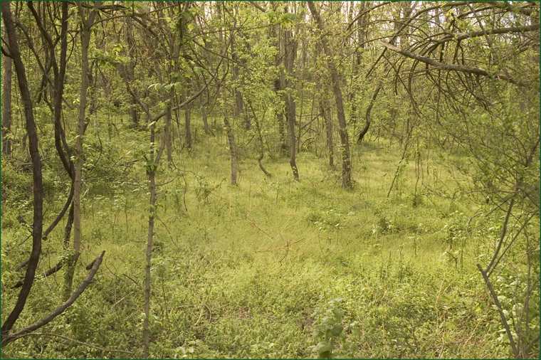
The site is vacant and unused, with an overall area of 36,468 sf (0.83 Ac), sloping slightly to the southeast.
If frequency of use and vacancy are problems, the Shenandoah national Park is in trouble.
The site is now vegetated primarily with invasive shrubs and trees, with a few larger native trees on its edges. Dense and weedy, it has become something of a dumping ground for passing vehicles.
Do you think that the small game, all God's creatures, that live back within the boundaries of "the site" look at one another and bemoan Invasive Species?
No, this is code for "we are going to dig up this piece of land and put our scheme in its place. Our stuff will look better than the self storage or the concrete plant."