Tuesday, February 02, 2010

high water

Monday, January 18, 2010

Slabtown


The world is often grey.
Midrange. In-between, in the middle of black and white.

Labels:

Sunday, November 08, 2009

Student Internship Positions Available


Rivanna River Basin Commission seeks student interns for 2010

Stormwater Tools for Localities: Research incentive based approaches to encouraging "advanced" stormwater management (from comp plan/ordinance changes to fee structures) in support of a grant to the Commission from the National Fish & Wildlife Foundation. Prepare report and present to the RRBC (2010 spring, summer, and/or fall)

Rainwater Harvesting: Working the System (graduate level internship) The Commonwealth of Virginia (Virginia Department of Health) is presently developing guidelines that will enable localities to more readily approve rainwater harvesting systems for use in public and private spaces. The guidelines are being developed with input from other state agencies (DEQ, DCR, and DHCD). The internship will include joining meetings with multiple state agencies and local stakeholders, reviewing state rainwater harvesting codes, providing technical review and recommendations to RRBC staff and committees, and helping coordinate a regional and/or statewide meeting. (Spring 2010)

Rivanna River Corridor Plan: Preliminary Steps Conduct background research into river corridor planning. Interview planning staff of Rivanna localities. Research funding opportunities. Assist in writing grant proposals. Present to the Commission and other public bodies and their staff members. (Spring 2010 and beyond.)

Rivanna River Basin Commission/Technical Advisory Committee: Support the work of the Commission's Technical Advisory Committee, quarterly meetings and ad-hoc meetings of four subcommittees in between (Watershed Modeling, Rainwater Harvesting, Monitoring, and Workshops). This internship involves working with the RRBC staff to support the work of the Commission's Technical Advisory Committee and will range from meeting logistics, researching technical and policy issues to follow-up from meetings, taking subcommittee meeting notes, etc. (under-graduate or graduate level, ongoing)

Rivanna River Resources: What's Missing? Web and Graphic Resources for Understanding our Watershed. Review websites of similar organizations (Rivanna-based, other state or regional river commissions, etc.). Working with multiple existing resources bases and compilations, obtain documents and/or links to documents available online that will enhance the "Rivanna Resources" portion of the Commission's website. Work with RRBC Webmaster to modify RRBC website with additional materials selected. (under-graduate or graduate level, ongoing)

Rivanna River Basin Commission: Building an Inter-jurisdictional Body for Watershed Protection Meeting planning and support for the Commission itself, which meeting quarterly in 2010 (provide dates and times).(Suitable for under-graduates, with discrete dates and time periods. Good for satisfying community service requirements. Ongoing.)

For more information, contact Leslie Middleton, Executive Director, at 434-975-0224 between 8:00 am to 4:30 pm weekdays or email lmiddleton@embarqmail.com.


View Riverbend in a larger map

Labels:

Thursday, October 22, 2009

Rappahannock River


near Towles Point, Lancaster County, Virginia

We envision a future which celebrates our need to return to the river as a source of daily pleasure, a place of commerce, and a place of occupation brought about by interested citizens and groups working together.

Regarding water quality, Rivanna River Basin Commission's quarterly meeting is tonight, October 22, 6 pm - 8 pm, Charlottesville High School, A-Commons.

Thursday, October 22, 4:15 pm to 5:15 pm. Rivanna River Basin Commission hosts a pre-meeting presentation on the Charlottesville Water Resources Protection Program at the Charlottesville High School, "A-Commons." Tour of stormwater management features at CHS and discussion of the City's stormwater and water resources protection policies and programs.

Labels:

Friday, September 04, 2009

Norris Bridge


Town Creek , Callis' 6:39 am

Labels:

Wednesday, September 02, 2009

Rivanna River


Woolen Mills swimming hole. 0.91 miles to Monticello, 1.34 miles to the Pavillion, 5.14 miles to Wal-Mart.

Labels:

Saturday, August 15, 2009

around here


Northern Neck, Chesapeake Bay,Town Creek, Slabtown, Virginia

The south bank of the peninsula was the most popular location in Virginia for the People to live. An abundance of food. Formerly the world's richest estuarine system. Came a big trade in tobacco. The People had to be moved out. There was a war. New people were brought in to do the work. They didn't get paid. There was a war. Mechanized agriculture, steamboats, oyster houses and tomatoes, a few well fed years in the 20th C. The were several wars. The DDT, the phosphates, the sediment, the nitrogen that ran off the land, the parking lot lavage, it killed the creatures that lived in the water, the creatures that fed the People. Walmart arrived. The Gas got expensive. The tourists quit visiting. For the people who remained, there was little to do, little to eat.

Labels:

Monday, July 20, 2009

Westport River

Labels:

Tuesday, June 23, 2009

broken dock


post t-storm navigation hazard.

Labels:

Monday, March 09, 2009

changeable


last week it snowed, this week we went swimming. she is like the weather

Labels:

Wednesday, March 04, 2009

Corrotoman, western branch


37.764N 76.481W people tell me this is where Amiee Mann grew up. Wikipedia says otherwise.

Labels:

Friday, October 03, 2008

Transpiration


London is on a river, Paris is on a river, Charlottesville is on a river

If we were to hold our local waterways in higher regard, what would that look like? In the fall of 2007 architect W.G. Clark held a design studio at UVA that worked on this question.

The Rivanna River forms the eastern boundary of Charlottesville, and Free Bridge is the city's primary eastern entrance. As a major natural feature so important to the founding and history of the city the river is nevertheless curiously invisible. This project seeks to create a place that will encourage use of the river and provide a better understanding of its natural and cultural importance.--WGC

"Transpiration", an exhibit of student work from the University of Virginia School of Architecture, will be shown at the Charlottesville Community Design Center during the month of October. Projects engage both landscape and building, and are located along the streams, rivers, and water infrastructure of Charlottesville. This show hopes to reveal the potential of design and representation to transform public perception of the city's hydrological network.

The exhibit features work by Graduate and Undergraduate Students at the University of Virginia School of Architecture Studios: Lucia Phinney, Jeana Ripple, Nancy Takahashi, W.G. Clark, and Robin Dripps. Independent: Zoe Edgecomb, Katherine Pabody.

"Transpiration" opens Friday, October 3 at 6:00 p.m., and runs through the month of October.
The exhibit is located at the Charlottesville Community Design Center 100 5th St. NE Charlottesville, VA 22902. That is on the north east end of Charlottesville's downtown pedestrian mall.

Labels:

Sunday, August 17, 2008

day of rest


Resurrection River

Labels:

Friday, September 28, 2007

postop


The anesthetic lingers, the DVM suggests protecting Sophie from herself for 24 hours, no stairs, no swimming, no operating heavy machinery.

Labels: ,

Thursday, August 09, 2007

070809


Rivanna River from the top of the Woolen Mills dam

Labels: ,

Tuesday, February 20, 2007

Alosa sapidissima


Shad arise from the Atlantic Coast rivers. The St. John's River in Florida is the southern-most shad spawning ground.
Shad and salmon are anadromous. They migrate from salt water back to their river of origin to spawn.

Chesapeake Bay Foundation
The Founding Fish by John McPhee

Labels:

Monday, February 12, 2007

Suwannee


29°57'18.58"N, 82°55'46.79"W

Labels:

Friday, February 02, 2007

Ichetucknee


29.98575469370,-82.76012440900, upstream from Hog Island. Ichetucknee State Park

Labels:

Monday, October 23, 2006

Town Creek

Wednesday, September 27, 2006

technology


Woolen Mills dam, c. 1930

Labels: ,

Thursday, August 10, 2006

semper fi


Headed for Quantico, Emory H. finishing there Friday, then on to TBS.

Labels: ,

Wednesday, August 09, 2006

water quality


Advice to swimmers? Keep your mouths shut.

For more information on bodies of water in the Rivanna watershed visit Streamwatch
:(

Labels: , ,

Tuesday, August 08, 2006

Rivanna River


Rivanna Conservation Society river regatta, June 17. The Rivanna serves as the eastern border between the City of Charlottesville and the County of Albemarle from Rivanna Park to Bland Circle. The regatta started at Darden Towe Park in the County (the City has no formal boat launching points).

Labels:

Sunday, July 30, 2006

downstream from Monasukapanough


Rivanna River
For thousands of years the Monacans were widely dispersed over all of Piedmont and Mountain areas of Virginia. Towards the Late Woodland era, ca. AD 900 - 1700, a pretty strong emphasis of villages on the major rivers for access to transportation and trade and good agricultural soils. From the South Fork Dam east along the Rivanna there is abundant evidence of Monacan villages, as any local farmer or housing developer can tell you, all the way to juncture with the James. --J.L.Hantman

see also Th. Jefferson, Notes on the State of Virginia

Labels: ,

Thursday, July 20, 2006

Piraeus


view of Security Storage and Van Lines from across Moores Creek

This past Monday night Charlottesville City Council voted to deny a petition to upzone the backyard of Woolen Mills "Lot #1". The vote was unanimous and in agreement with the recommendation of the Charlottesville Planning Commission.

Woolen Mills Road background.

Labels: , ,

Friday, June 23, 2006

overboard


The quality of sunlight varies with geographic and climatic conditions. Photographers rave about the light in the high Sierra. It is rare to hear glowing reports about summer light in Virginia. The landscape becomes a duotone of grey and green, edges and contrast give way to the humidity which is palpable and visible.
Note to Ansel, go somewhere else.

Labels: ,

Saturday, June 17, 2006

summertime


There is a party on the River today. People recreating in canoes, kayaks and maybe a few inner tubes. In the days gone by, children from the Woolen Mills Village swam in the Rivanna above the dam, never below.
Never below? In the first half of the 20th Century the City of Charlottesville had a straight-pipe that emptied into the River near its intersection with Moore's Creek. Brown trout swam below the dam. Flush hard! Richmond needs the drinking water.
To learn more about Rivanna water quality visit StreamWatch.
"The ultimate purpose of StreamWatch is to help maintain and improve the health of streams and rivers in the Rivanna basin. Many organizations and agencies share this goal, and a key principle of StreamWatch is the recognition that conservation is a community effort?that close cooperation between individuals and groups is essential to successful watershed management."

Labels: , ,

Monday, April 17, 2006

Moore's Creek


Some of the land being considered for protection by means of conservation easement as a stream buffer for Moore's Creek

The Rivanna Water and Sewer Authority will unveil the area's water supply plan tomorrow night. It is a good plan.
Part of the plan will necessitate what the EPA folk call wetlands mitigation. The wonderful thing about how this is playing out is that it looks as if our local riverine environment and the viewshed of Monticello will both be improved by this project.
Charlottesville City Council member Kevin Lynch has a great idea how to accomplish these improvements.
RWSA is holding a Public Outreach Meeting 7 p.m. - 8:30 p.m. at Monticello Highschool, tomorrow, Tuesday April 17.
Please attend and support the water supply and mitigation plans.
The mitigation plan would help address one of our significant local "impaired waterways."


this is Moore's Creek just upstream of where Jefferson would cross on horseback and, 70 years later, Woolen Mills Village residents would cross by footbridge

Of the three segments listed for fecal coliforms, the one with the
smallest watershed, 35 mi2, is that of Moore's Creek (which has 6.37 miles that are listed
as impaired, from the intersection of Rts. 29 and 1106 to the confluence with the Rivanna
River). In spite of its size, it is a diverse watershed which reflects the diversity of the
Rivanna Basin.

-tjpdc.org

Labels: , ,

Tuesday, March 28, 2006

waste water


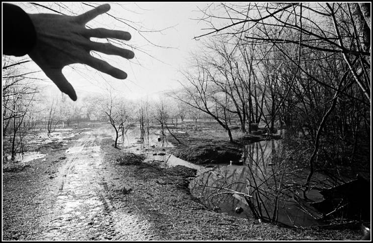
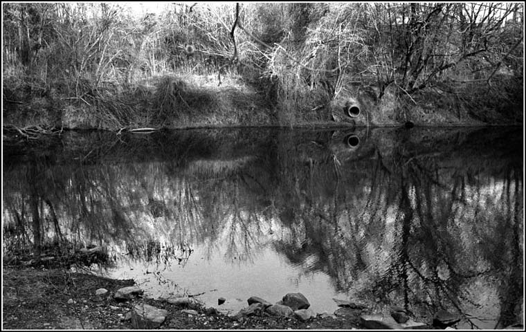
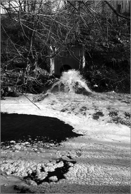
RWSA outlet into Moores Creek, currently running at approximately nine million gallons per day

Missed posting yesterday, was busy assembling materials for the Rivanna Water and Sewer Authority board members. They received an excellent technical report from staff regarding the "Compost shed".
A contingent from the Woolen Mills neighborhood spoke before the Board relating the "quality of life effects" imposed by living near the steaming pile, an aspect the technical report didn't specifically address.

Note! Brian Wheeler has posted RWSA audio on his website Charlottesville Tomorrow

*************************************************

In 2003, then Mayor of Charlottesville, Mr. Maurice Cox, challenged city leaders and the Woolen Mills Neighborhood, he said:

I think it is long overdue for the Woolen Mills that they have a clear signal of where their neighborhood is going, and (that it) not be done in this piecemeal fashion.
So I guess my hope would be that out of this process, given the talent that they have in their neighborhood, that they get together and decide that proactively:

'we are going to tell you what the future of our neighborhood is going to be,'

and it is not going to continue to be an erosion of the things that they have come to feel anchor their neighborhood, that?s the residential use and some of the mixed use strategies that they have."
-Maurice Cox April 2003

I personally long for the time when businessmen built their residences next to their places of business, when they were members of a neighborhood, sharing the positive and negative effects their endeavors had on the quality of life in the area they called home.

Such was the case 100 years ago when 
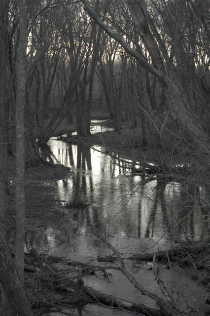
Henry Clay Marchant lived on hill at the intersection of Moores Creek and the Rivanna River. He was the directing force of the Charlottesville Woolen Mills and his house overlooked his place of business.

The neighborhood takes its name from Marchant?s enterprise and as the business was the seed around which a neighborhood coalesced, the Woolen Mills is often considered by people who don?t know better as an ?industrial? neighborhood.

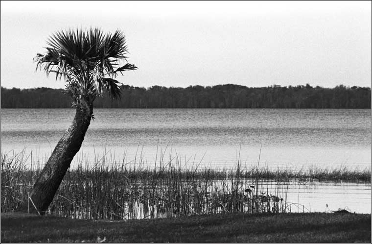
The Woolen Mills is a residential neighborhood, a Mill Village whose residents historically walked to work. Marchant?s industrialism fit well with the arboreal garden at the base of Monticello Mountain.

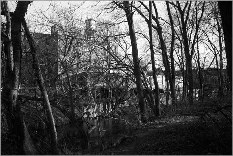
The industrial park that lines Broadway Street between RWSA and the Woolen Mills neighborhood was, in the time of the Mill?s operation, a recreational park. My ninety-seven year old neighbor, Lola Knight, remembers watching baseball games there. Sixty-nine year old Jean Strauss remembers playing shuffleboard in the park in the mid 1940?s.

One questions the wisdom of the City and County zoning that has located some of the heaviest industry in this region at the foot of Monticello Mountain, in the view-shed of the crown jewel of Central Virginia tourism.

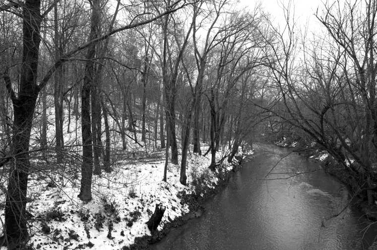
The Woolen Mills neighborhood shares its south-eastern boundary with Albemarle County. Living on an inter-jurisdictional border is a dangerous affair. RWSA?s county Supervisor is Mr. Lindsey Dorrier. Mr. Dorrier?s most distant constituents are the residents of the Marchant house. Does Mr. Dorrier feel and smell their pain?

Visitors to my house in the Woolen Mills neighborhood wonder why I don?t ask my City Councilor to address the smell issue. Indeed, we, as a neighborhood, have been asking the City Council for relief from the corrosive effects we bear from the industry to our South. We have been asking for relief from the cut-through traffic and smells at least since I moved to the neighborhood in 1987.

In 1918 the Woolen Mill bought its first internal combustion vehicle.

In May, of 2005, during a 24 hour period 14 septic-tank pumping trucks short-cut through the Woolen Mills neighborhood accessing the place where they dump their loads. In the same twenty four hour period thirty-two vehicles emblazoned with the RWSA logo made their way through our residential streets. I was busy counting the traffic that day, I failed to note whether the air smelled of ?composting bio-solids.?

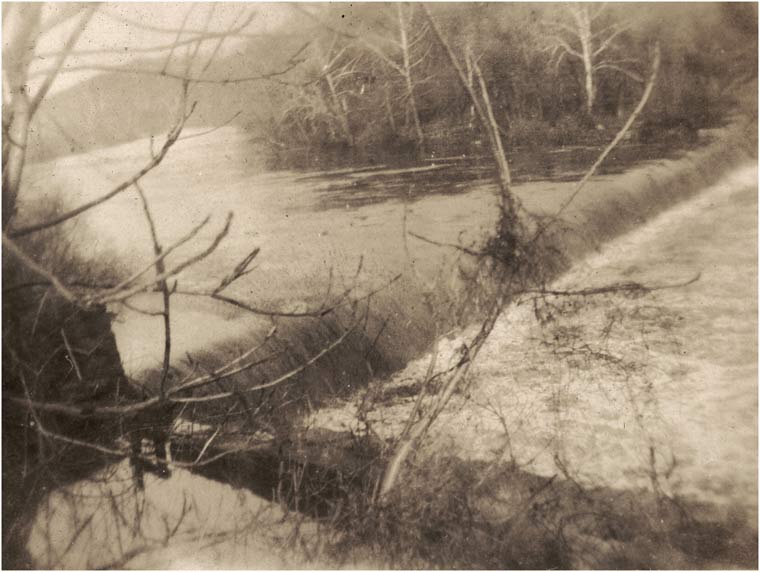
In the summer of 1916 the City?s main sewer pipe, a straight pipe running from the City of Charlottesville to the Rivanna, broke...

"Foul odors wafted across the mill village from the leak. The stench ended only with the arrival of the coldest winter in twenty years."
-Andy Meyers ?The Charlottesville Woolen Mills:
Working Life, Wartime, and the Walkout of 1918?


The leak was referred to in the Woolen Mills Board Minutes taken during the summer of 1917 a year later. Apparently the City was in no hurry to repair the failed pipe.

In my opinion, the odor we currently deal with comes close to meeting the definition of a public nuisance, described in state law:

"as an act that is injurious to health, indecent or offensive to the senses and that interferes with the comfortable enjoyment of life or property."

In 1916-1917 the City responded slowly to complaints from the Woolen Mills neighborhood regarding odor. We hadn?t been annexed then. We were Woolies, Lintheads and Albemarle County Residents to boot.

Show us that times have changed. Give us action to address the smell issue in the current year. Fast track enclosing the compost shed. Transform this mother of all outhouses from a source of community pain to a source of regional pride.

Labels: , , ,

Monday, March 13, 2006

nexus


The Woolen Mill located at the intersection of water and overland routes of travel. Three Notched Road crossed the Rivanna at Secretary's ford and ran up the spine of the Mill Village.

This view is taken from the vantage point of the RWSA compost shed perched 100 feet above the Moores Creek and the Rivanna. The train tracks bearing approximately 300 degrees NE.

Labels:

Monday, March 06, 2006

Moore's Creek


Walked 2.7 miles along the south bank of Moore's Creek Saturday morning. The walk made possible by the superb effort of the Rivanna Trails Foundation. These fine people and their volunteers have constructed walking trails around the City of Charlottesville.

Moore's Creek is listed by the Virginia DEQ as an "impaired waterway", it is burdened by organisms and chemistry that it is not supposed contain and it is missing the good stuff (living critters) that it used to contain. (Massive efforts are underway to repair).

The thing I love about the walk, there is a wildness in the midst of our urban environment and with effort it can be preserved and enjoyed, burning a gallon of gas to get to the Shenandoah National Park isn't strictly necessary.

The trail section ends abruptly at the point where Moore's Creek joins the Rivanna River. Hmmm. In former times this is the spot where Th. Jefferson was rumored to cross, course he was riding a horse. In more recent times (1913) there was a footbridge (note: you must check out the Holsinger photo!!!)

We were on foot. Waded from the base of Monticello mountain through Moore's Creek to Sand Island. From Sand Island we waded again to the south bank of the Rivanna and the terminus of Woolen Mills Road.

Labels: ,

Wednesday, February 08, 2006

Piscataway Creek


37 52.498N 76 54.295W
Moving by this point at 88 ft/sec there is the slightest hint of beauty. Parked a couple hundred yards up the road. Walked into the east wind generated by 18 wheeled vehicles. No where safe to stand.

Labels: ,

Sunday, January 22, 2006

day of rest


Rivanna River, Church of the Blue Dome

Labels: ,

Sunday, January 15, 2006

day of rest


Church of the Blue Dome, enough of the Sand Religions

Labels:

Tuesday, December 13, 2005

Victory Bridge


Flaubert wrote, "To be stupid, selfish, and have good health are three requirements for happiness, though if stupidity is lacking, all is lost."

Labels: , ,

Wednesday, November 23, 2005

downstream


For the first time in my life I felt I had been betrayed by my mind.

Labels:

Tuesday, November 01, 2005

white line


The City has been creating and maintaining pedestrian and bike paths, a wonderful alternative to automobile travel. Since the right of way above was secured, the path has been modified:

a) a law was passed requiring dogs be leashed Friday-Monday
b) the path was paved
c) the path was striped

The physical modification, the pavement, has rendered the park more appealing to bikers and roller-bladers. Someday we will see a wheelchair (haven't seen one yet).

The symbolic modification, the white line, has not effected the behavior of out of control children and dogs. Adults typically make way for traffic approaching from the opposite direction. Of course, people with functioning brains reacted to oncoming traffic in such a way before the advent of the stripe.

The legal modification, the leash law, is a joke. Compliance is close to non-existent.
(If I was emperor of CHO I'd modify the leash law to include children under 10 and I would try enforcing this law one percent of the time.)

Labels: , ,

Friday, October 28, 2005

watershed moment


Over the years I've attended many meetings sponsored by our City. We meet with a neighborhood planner, Our input is earnestly solicited. We are invited to share our vision for the future of our neighborhood. And then? Next to nothing happens. The quality of life in the neighborhood continues to degrade.

So it goes. The beautiful historic neighborhood I live in is now a short cut for multi-axle traffic from an industrial park and for drivers shaving stop lights off the daily commute.

The City talks neighborhood values while developers cut building lots out of our cemetery.

Most of my neighbors have given up on the meetings. Meetings are crap. Meetings are a thing the magician does to divert attention with while the degradation continues.

Last night I attended a meeting regarding the future of our water supply. One of the my neighbors was in the room.

RWSA, our local water and sewer authority, has held a series of public outreach meetings on the question of where our drinking water should come from.

RWSA has taken the community input about the water source and they are acting to realize the vision! The vision is one of stewardship, living within the means provided by our watershed. I am cautiously optimistic.

It was a meeting with a difference.

****************************************

It looks like RWSA is seriously considering:

Option #1 ? Charlottesville Pipeline

Increase the height of the Ragged Mountain Dam to allow for greater water storage. Connect the Ragged Mountain Reservoir and the South Fork Rivanna Reservoir with a new 10 mile (est) pipeline. Turn off the 100-year old 12-mile Sugar Hollow pipeline (slated for replacement) that fills Ragged Mountain today. Fill the expanded Ragged Mountain reservoir from the Rivanna Reservoir using the new pipeline. Balance water treatment between existing facilities.

Earlier in the process the Chinatown scenario prevailed, stick a straw in the James River at Scottsville...

The Daily Progress has a more balanced report. "Rivanna water options narrowed to 2"

Labels: , ,

Tuesday, October 25, 2005

33 years later


I asked candidate Toscano whether he'd support "scenic river" designation for the Rivanna River in Charlottesville and he sounded genuinely enthusiastic.

Key to improving water quality is self interest. We need people in the water, by the water, on the water, recreating, becoming aware of this resource.

(33 years after the clean water act)

Labels: , ,

Friday, September 09, 2005

oof ftd stp

grey
Rapidan river fog

Wednesday I was making fun of OOF, out of focus. But truly, the rule of photography is there are no rules.
There is no rule but one.
Take off the lens-cap.
Fog is akin to OOF, fog lowers contrast, blurs detail and in so doing reveals a larger truth, the role of distance. Fog reveals what is near and what is far.
If an image has appeal when blurred its design elements are good.

When I squint until I can barely see the hurricane's sequelae an essential truth looms. Everyone screwed the pooch.


Belated thanks to Chad Dotson, Virginia's elected blogger, for hosting the first Virginia Blog Carnival!

Labels:

Friday, August 19, 2005

resource extraction

upper reaches of the Mattaponi River
Tucked away in the coastal plain of Virginia is a pristine freshwater river, the Mattaponi. Doesn't look like much here where it runs under Burke's Bridge Road.

Shad run in the Mattaponi, Virginia's first people have lived in this neighborhood for eons. The river goes tidal further downstream, joins the Pamunkey River at West Point to form the York River.

The City of Newport News wants this water. Hey! Whose going to miss 75 million gallons a day? The people who live close to this river don't have much clout, they are rural people. Newport News has plenty of clout.

"the project would result in the largest authorized wetland loss in Virginia, and in the mid-Atlantic region, in the history of the Clean Water Act section 404 program."

"The reservoir would destroy at least 437 acres of wetlands, and inundate 21 miles of free-flowing streams, wiping out the unique Cohoke Creek watershed. In addition, 187 acres of wetlands located below the dam would be severely degraded due to reduced flow in Cohoke Creek. The proposed reservoir would also threaten recovery efforts for the fragile shad fishery."


(quotes above from the Southern Environmental Law Center website)

Labels:

Wednesday, August 10, 2005

in time


Went by the ferry to put a name to the dog, dog's name is Merry. OK, Merry on the ferry, really. Merry and Sophie got along but I couldn't snap the meeting, Sophie jumps off boats.

Morning glories are in the corn, the hallucinogenic variety, heavenly blue.

What did Bob Dylan say? Those that aren't busy born are busy dying?

Labels: , ,

Tuesday, August 09, 2005

merry point


This is the Merry Point, Virginia ferry. Runs six days a week, sunrise to sunset, weather and tides allowing. It is a cable ferry, capacity 2 cars, operated by the Virginia Department of Transportation.

Didn't get the dog's name. She lives in a house on the north bank of the Corrotoman River. When the mood suits she comes down out of her house and rides back and forth.

Labels: , ,

Sunday, August 07, 2005

the other side


Getting to the other side. Cross the river by virtue of work, but there is waiting involved.

How long?

Labels:

Tuesday, July 12, 2005

seven lean years


parking lot drainage

Vision Statement:


The Rivanna River Roundtable has developed a vision for the future of the basin based on the understanding that a healthy landscape, diverse ecosystem, clean air, clean water, and beautiful scenery add value to the local economy, and sustain the quality of life.

We envision:
? a river treasured as an investment in the future of the region, a resource worthy protection;
? a river occupying a vital place in the continuing history of the region;
? creeks and rivers which define what it means to be part of a special place, reinforcing residents sense of place and community;
? streams and rivers as accessible recreational resources, providing inspiration and educational opportunities for future generations;
? a river closely integrated into the cultural life of the region;
? streambeds providing habitat for river life and containing less silt, more rocks and riffles;
? forests and trees providing habitat and shading the streams and rivers, thus providing a habitat for fish and birds;
? a landscape that allows rainwater to seep slowly through the ground, providing recharge for summer creeks, while limiting flooding;
? swimmable, fishable streams for our future generations;
? clear and clean waters bound by fully vegetated stream banks, with topsoil in place;
? a future created by interested citizens working together and celebrating our need to return to the river as a source of daily pleasure, a place of commerce, and a place of occupation, and as a reminder of our history.

The Rivanna River Roundtable Report was released in May of 1998.

Meanwhile, the Rivanna has been busy transporting its silt and bacteria load downstream.

Labels: ,

Monday, July 11, 2005

rivanna river


failed sediment and erosion control


There is a story in today's Daily Progress as well as a news release on the Nature Conservancy website about a million dollar donation from the Nestle Waters Corporation to help figure how to facilitate "ecologically substainable water management" on the river that runs through Charlottesville and Albemarle.

My two cents. City of Charlottesville, County of Albemarle, enforce the soil and erosion control regulations already on the books. Make maintenance of effective erosion control measures part of the building inspections process.

When mud starts oozing into the Rivanna, issue a stop work order. Grab the developers by their pocketbooks.

?As the region?s population continues to grow, inappropriate residential development and excessive water withdrawals pose the most imminent threat in the Rivanna River watershed,? said Ridge Schuyler, director of the Conservancy?s Piedmont Program in Virginia. ?Sediment runoff is suffocating the river system and reducing the capacity for the region?s water supply, while water withdrawals have the potential to suck life out of critical rivers and streams. We believe that with good science-based information, The Nature Conservancy and its partners can help to protect the river as the region?s water demands increase.?

Labels: